Skip to what you can do
TN Waste Watch
Matlock Bend Class I Landfill · Loudon County, TN · permit SNL530000203
Take action
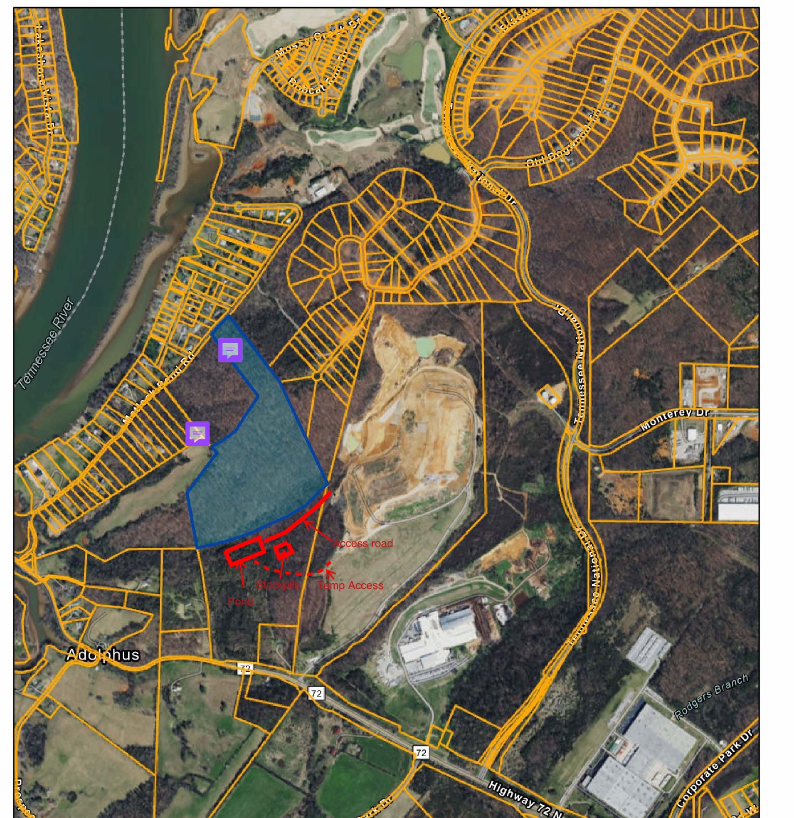
Loudon County assessor parcel map of the Matlock Bend landfill. The bare, terraced landfill working face sits at centre, bounded on the west by the Tennessee River and ringed on the north and east by dense residential lot lines.

Loudon County, Tennessee

The landfill is growing toward the houses. The permit is already filed.

Every orange line on this map is somebody's property boundary. The bare ground at the center is the working face of the Matlock Bend Class I landfill. Republic Services has submitted Part One of a permit to expand it horizontally.

Chapter 01 The filing

This is not a proposal. It is an application in progress.

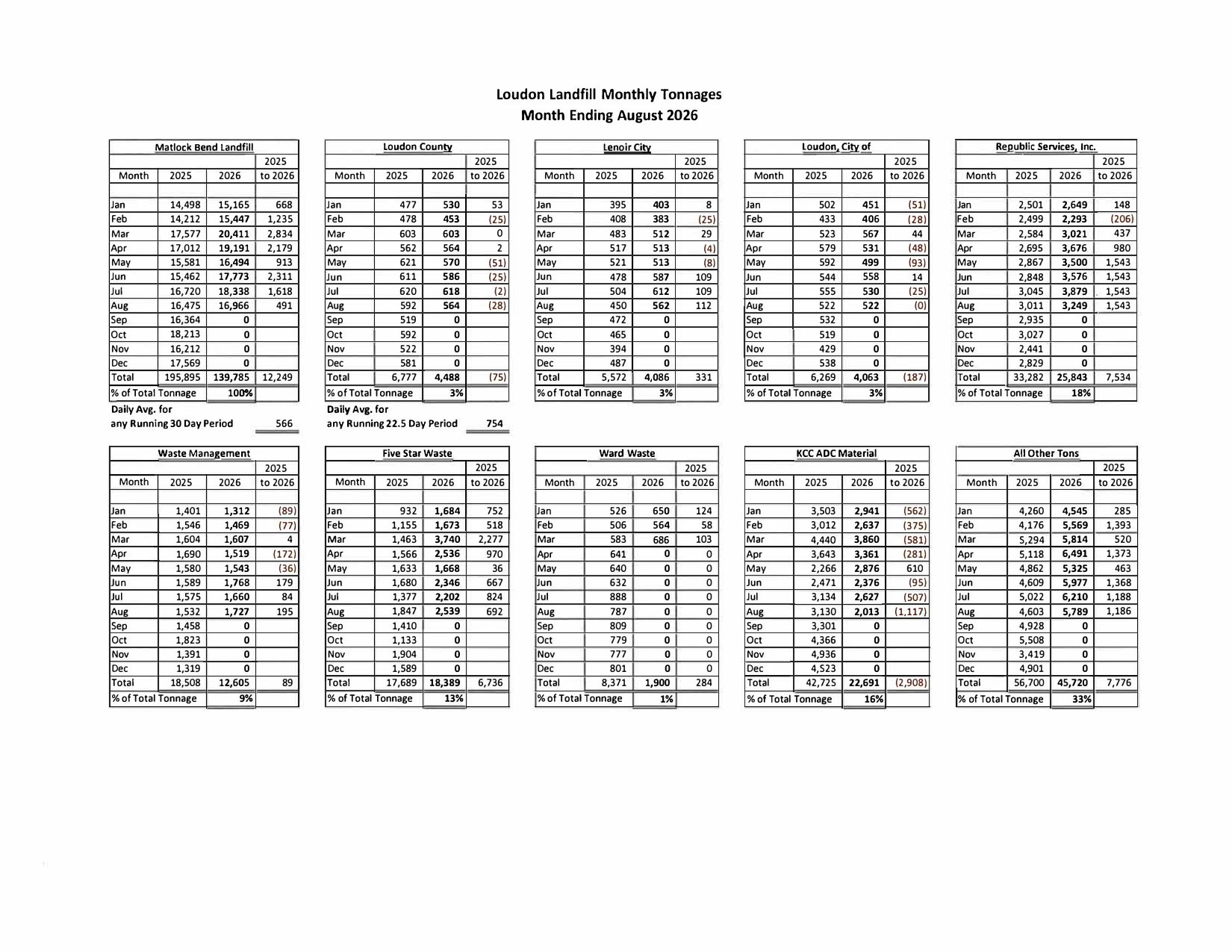
Part One of the horizontal expansion permit has been submitted. The geotechnical investigation is ongoing and is expected to continue into early 2027, with water quality work to follow. All Army Corps of Engineers jurisdictional requirements are complete, and the hydrogeologic work plan already given to the Commission supports the Part Two submission.

"On the horizontal expansion permit, Part One has been submitted; the geotechnical investigation is ongoing and expected to continue into early 2027, with water quality work to follow. All Army Corps of Engineers jurisdictional requirements have been completed, with no land-development obstacles identified." Engineering report, Republic Services, in the minutes of the August 20, 2026 regular meeting, as circulated in the September 17, 2026 Commission packet, p. 8.

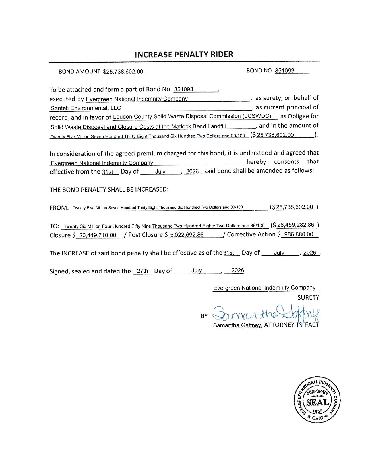
The county is on the hook. Republic Services operates the site, but the landfill permit is held by Loudon County through this Commission — which is why TDEC asks the county, not the operator, to formally answer for conditions on the ground.

"TDEC has asked that the permit holder — Loudon County, via the Commission — formally acknowledge the condition, since the landfill permit is held by the County even though Republic operates the site." Engineering report, in the minutes of the August 20, 2026 regular meeting, September 17, 2026 packet, p. 8.
2027
Geotechnical work expected to run into early
52.56
Deeded acres, parcel 031 047.00, per the county assessor
10
New gas wells with passive flares being installed in the capping section
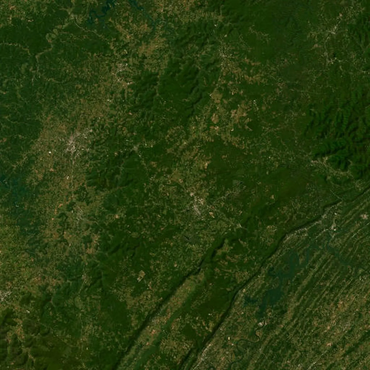
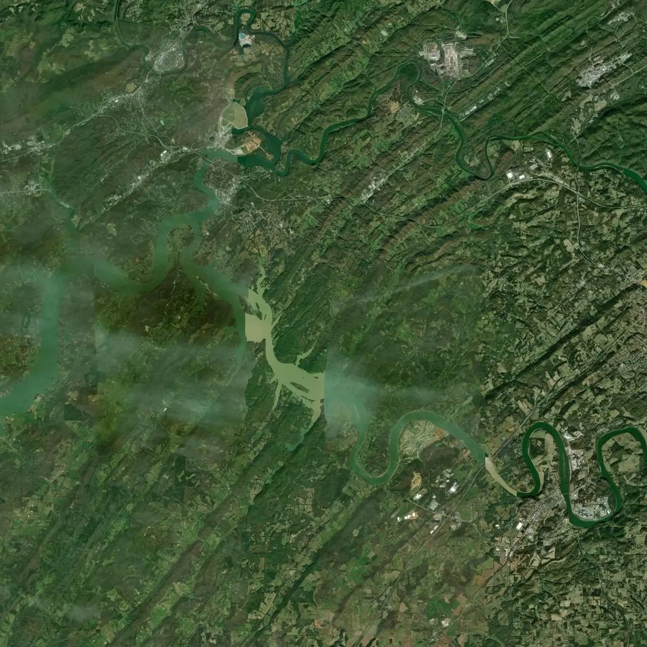
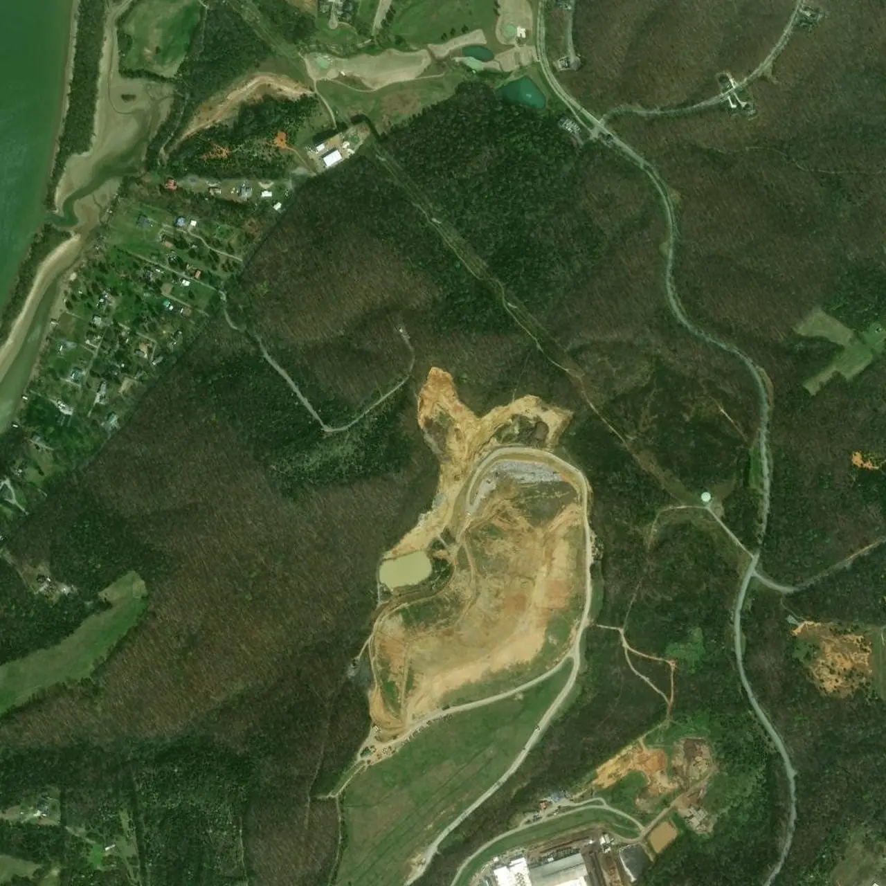
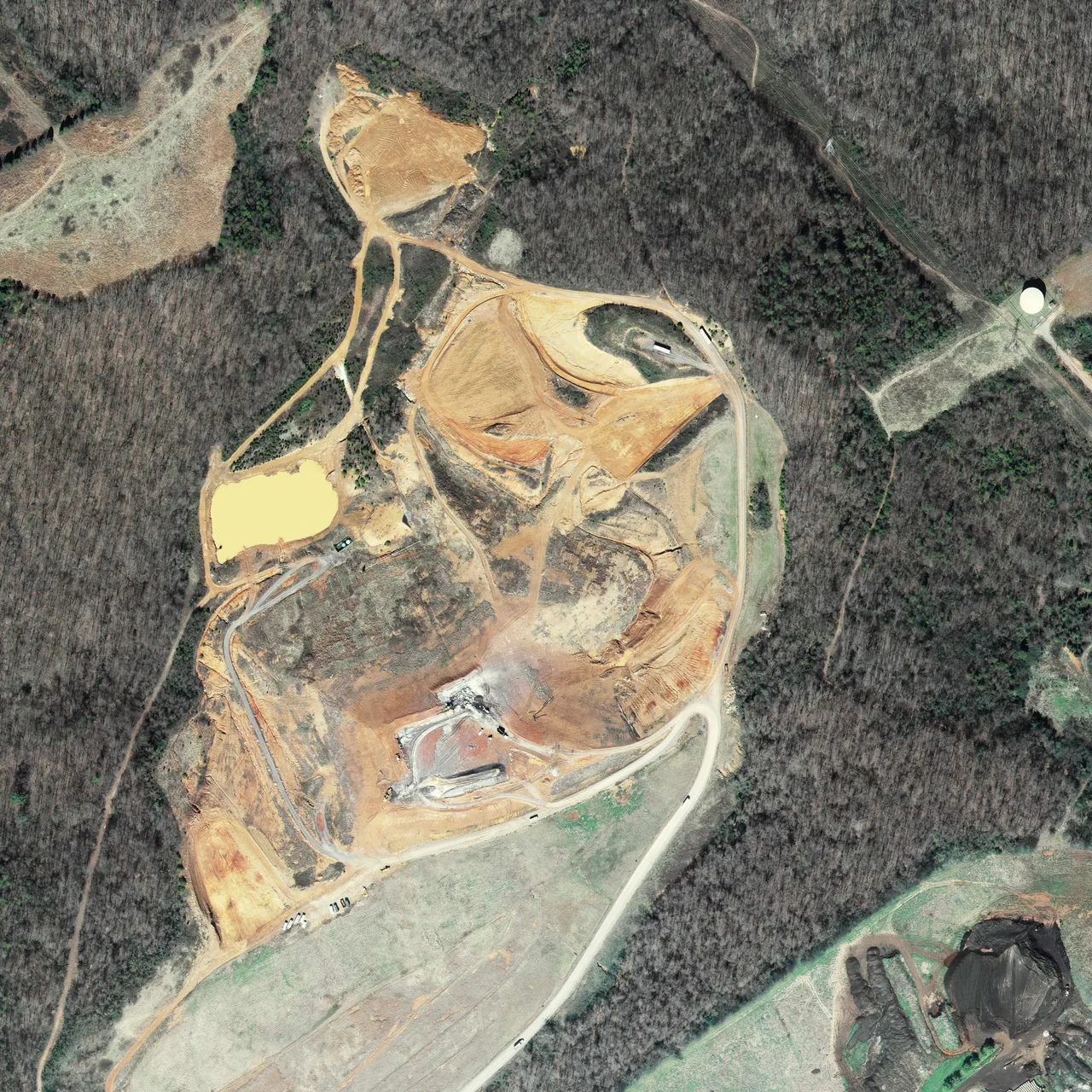
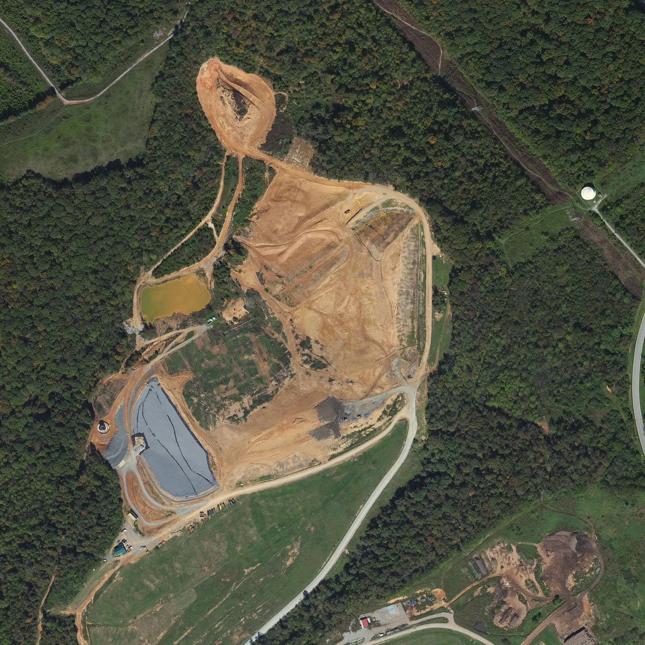
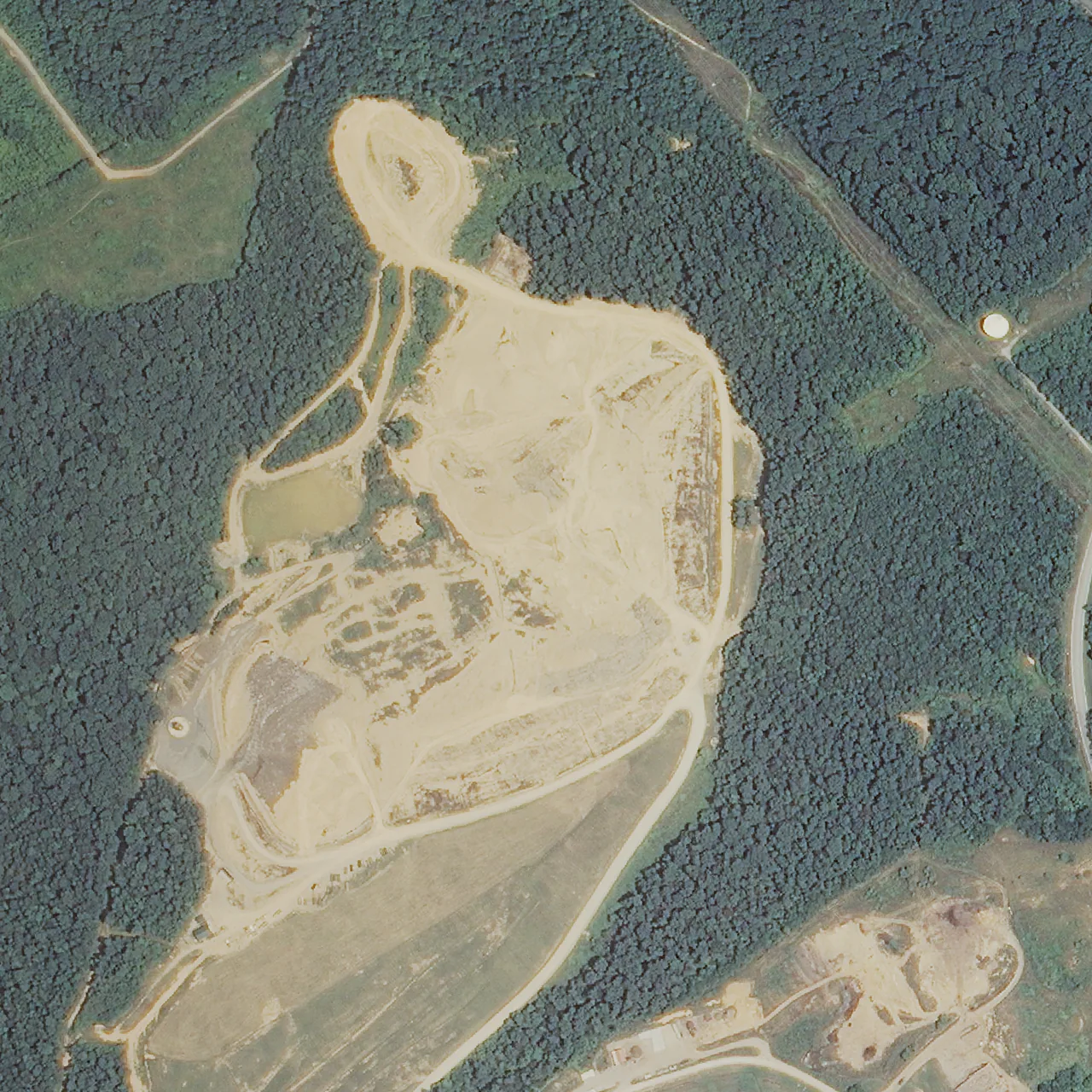
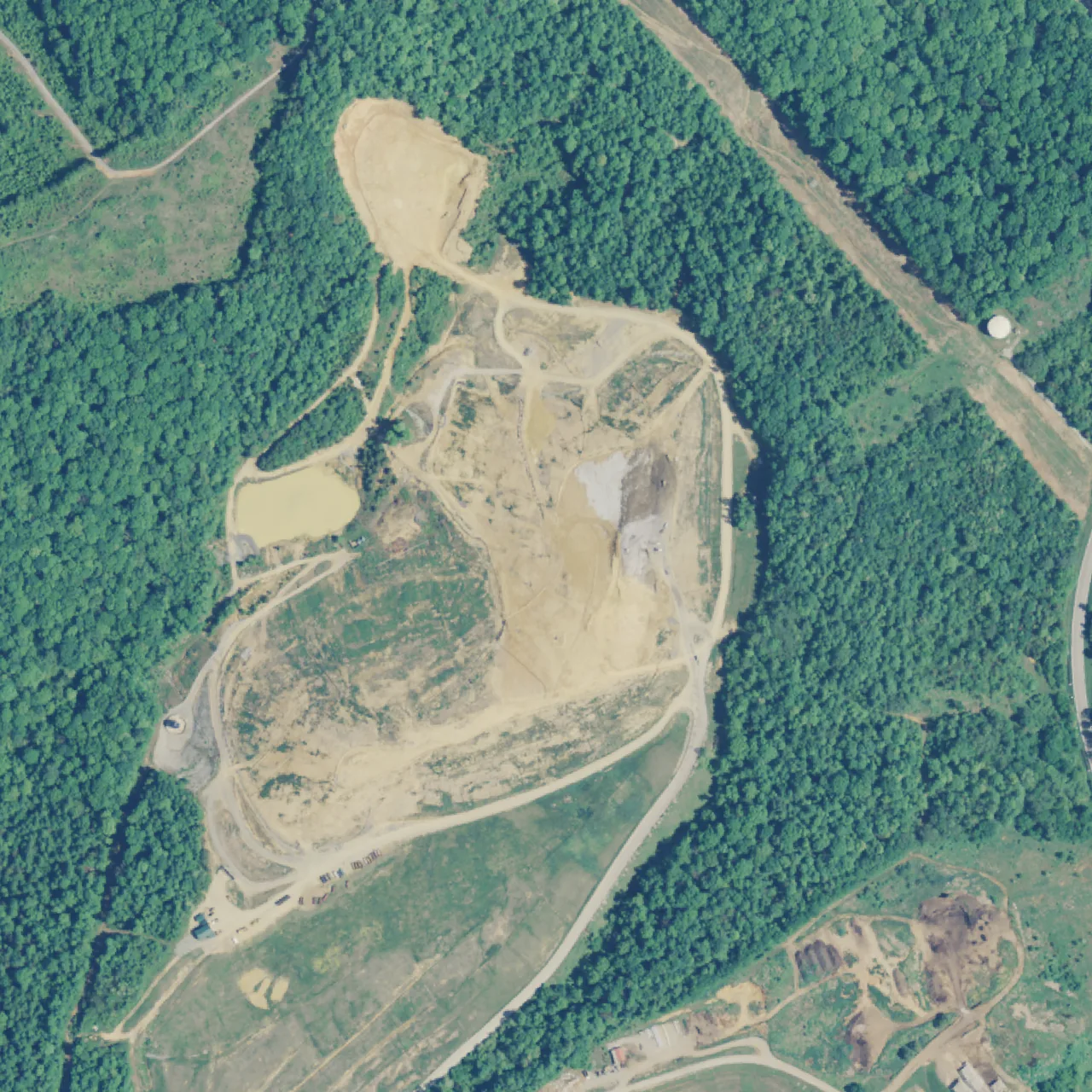
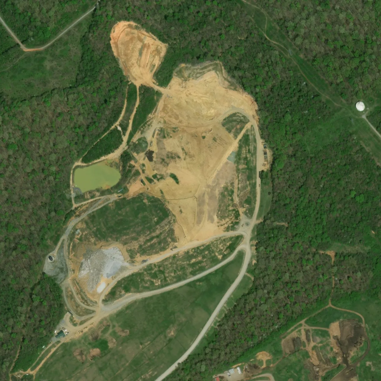
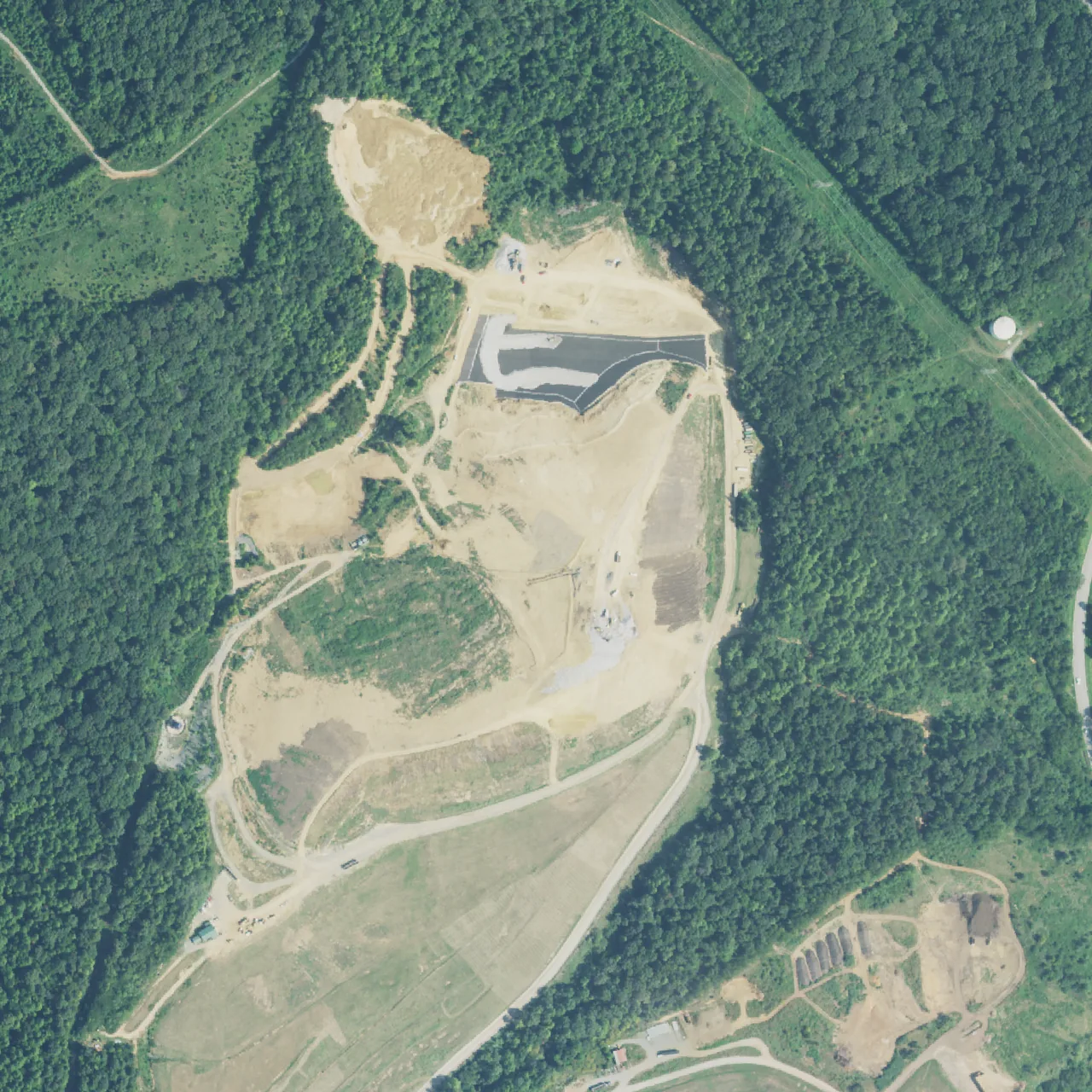
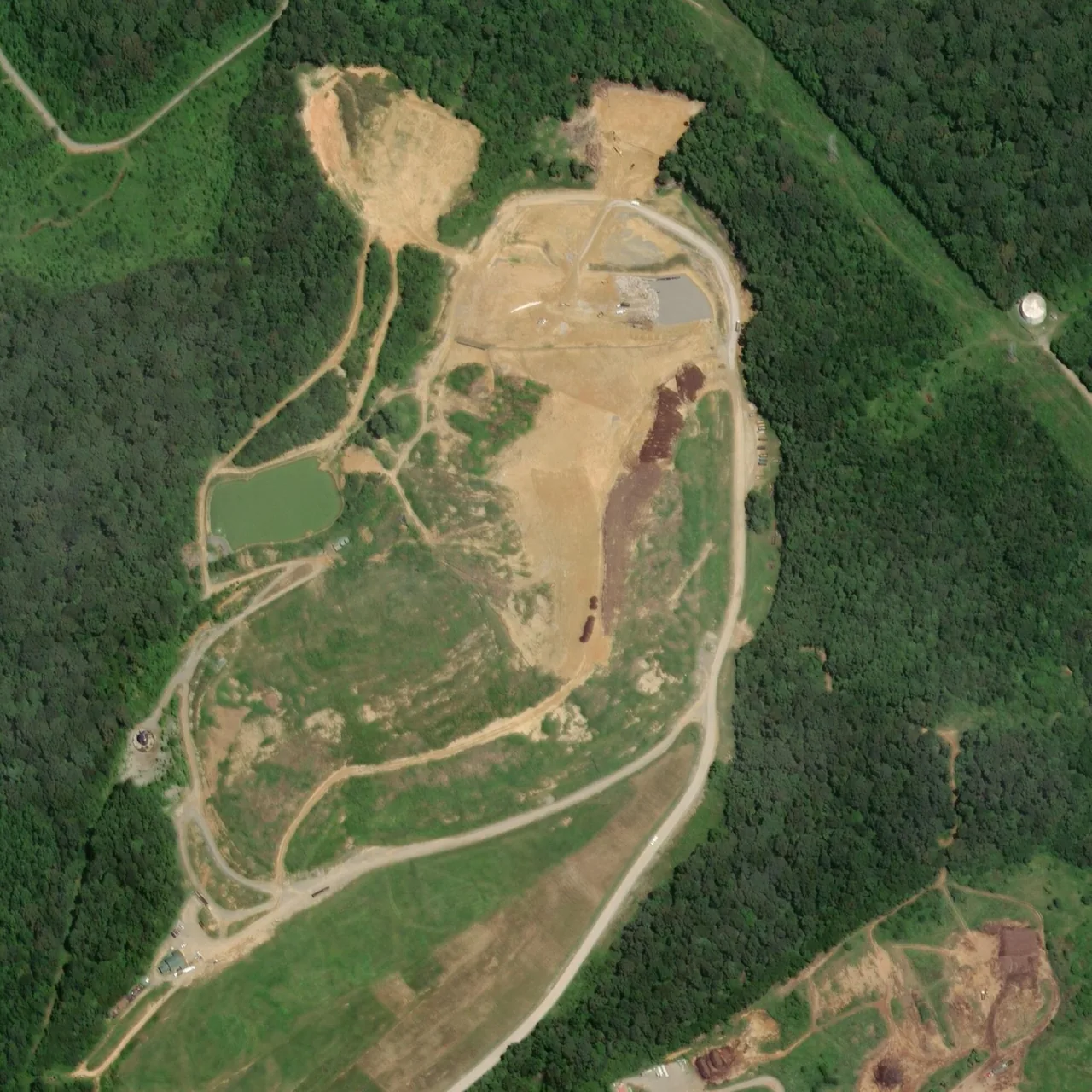
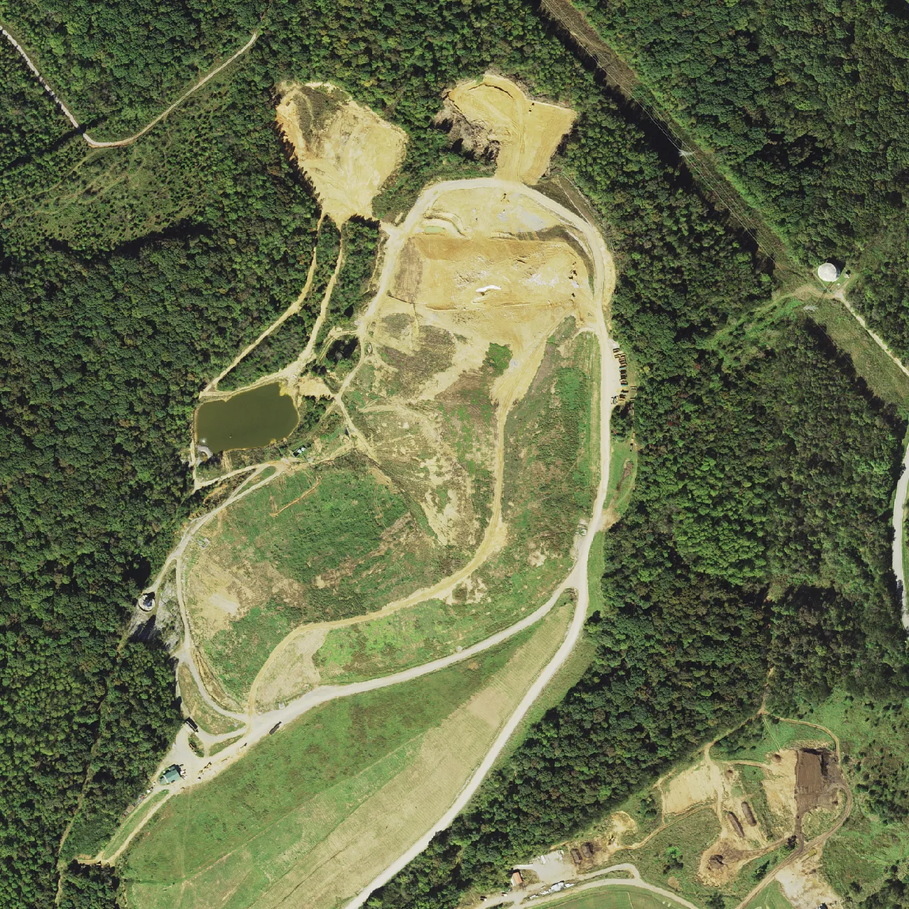
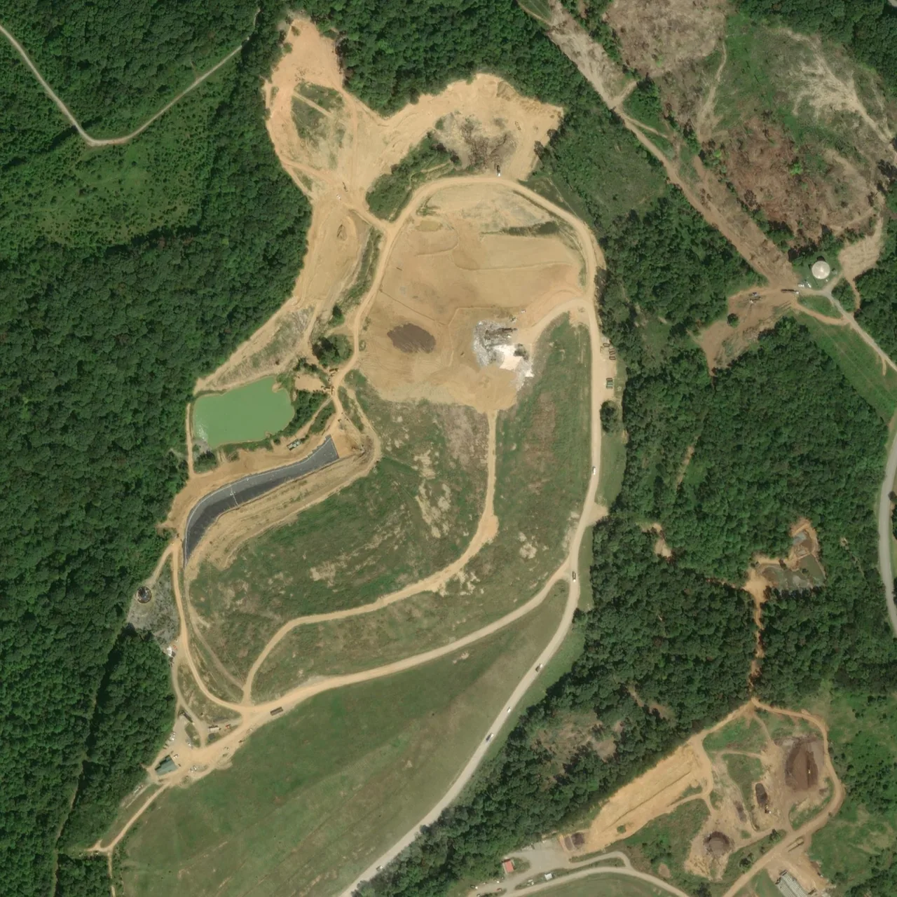
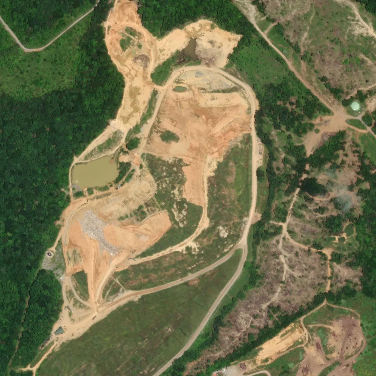
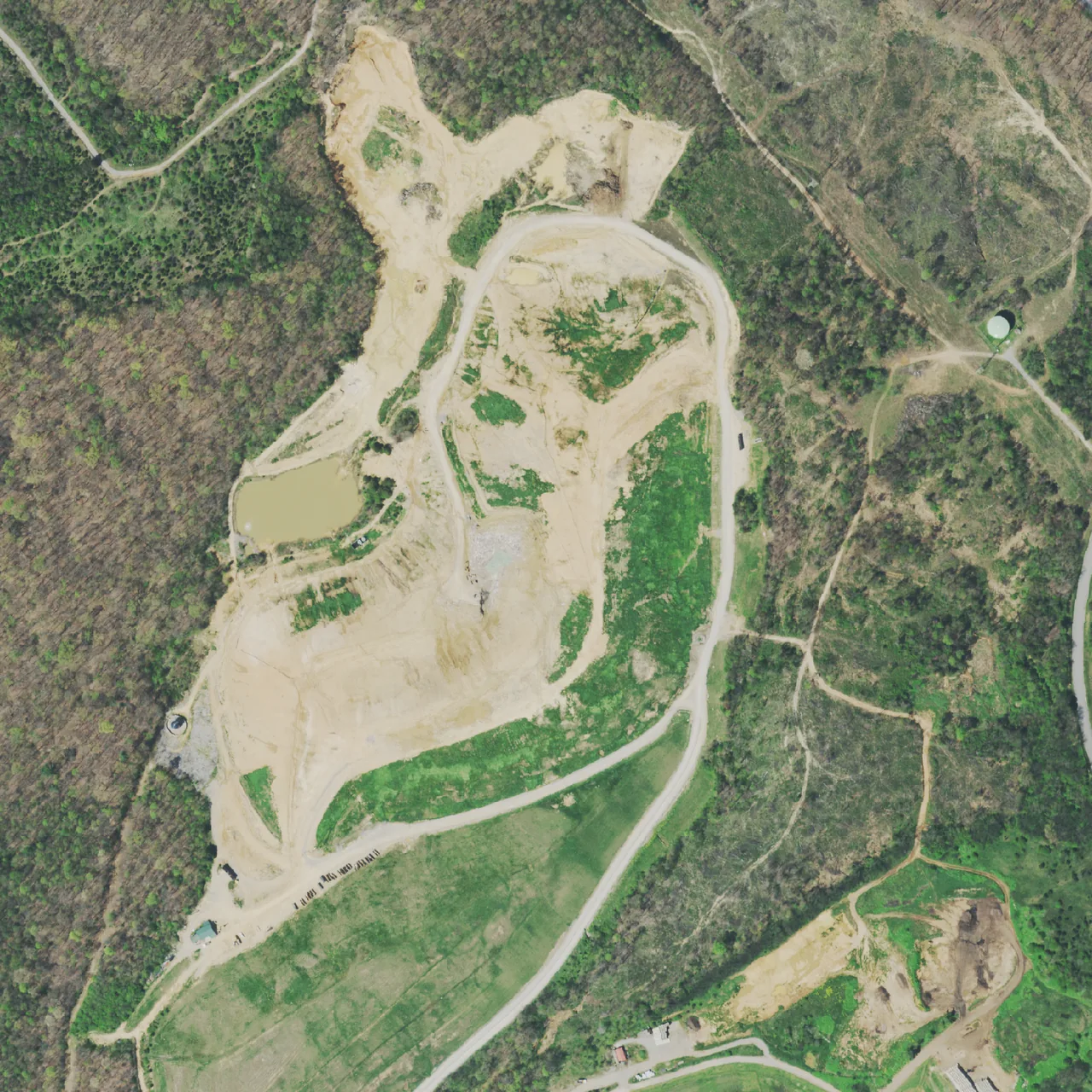
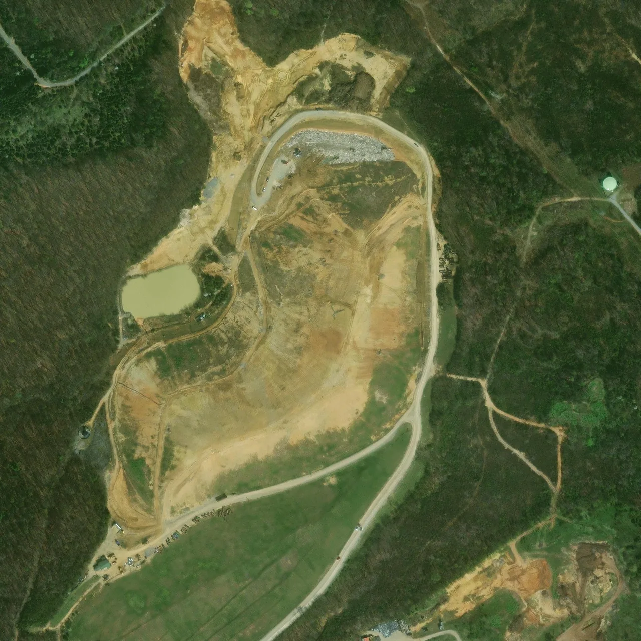
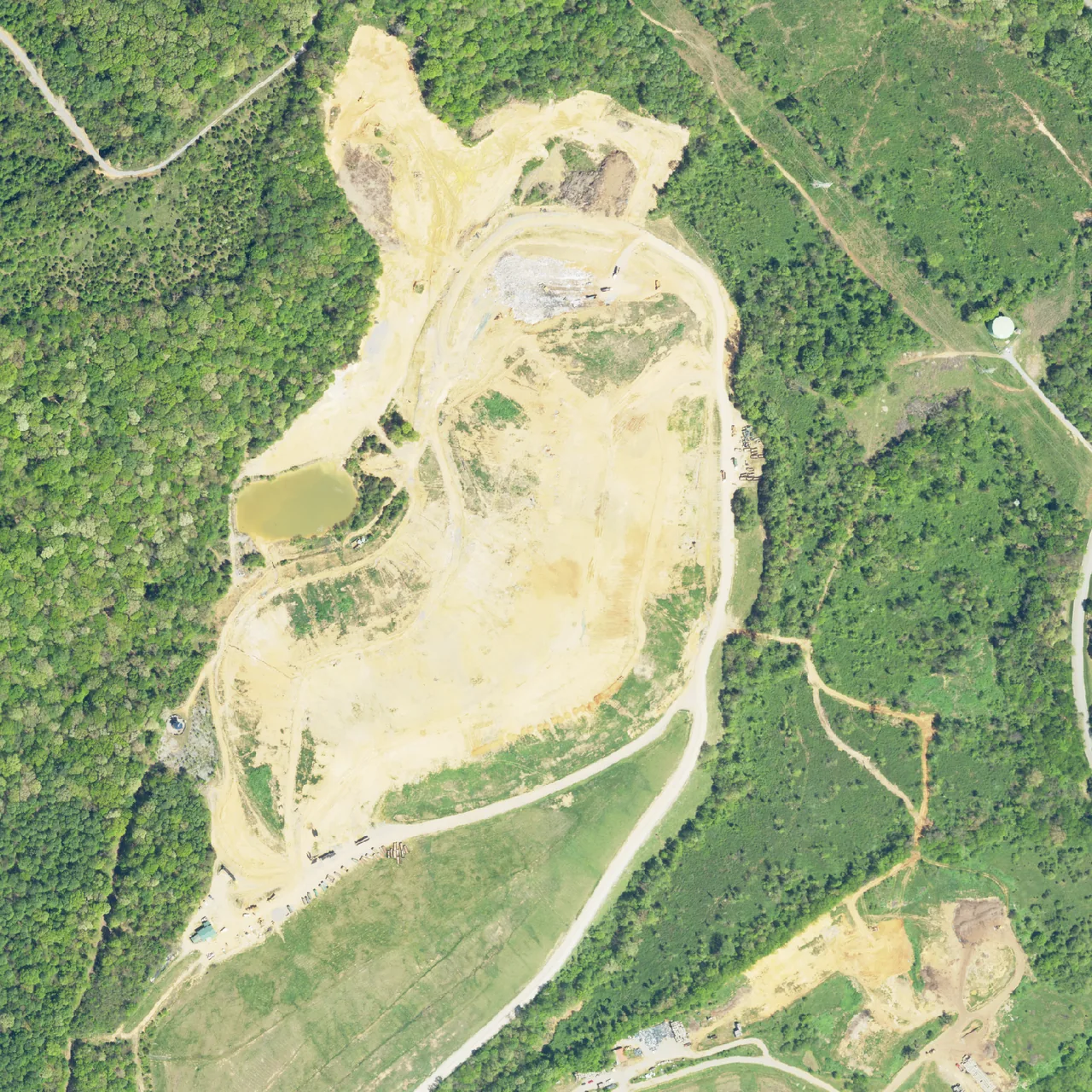
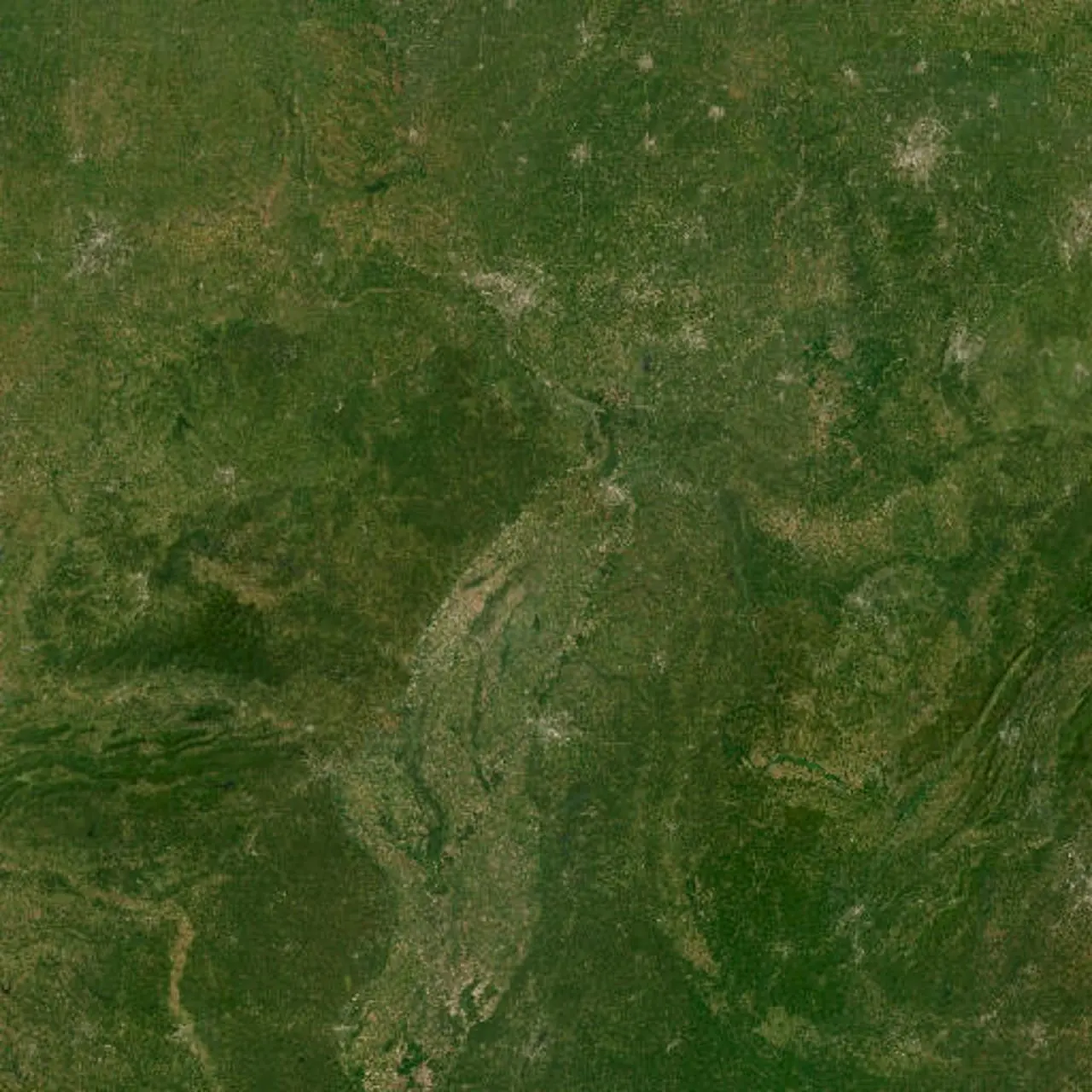
North America from orbit. The eastern United States. East Tennessee, the Valley and Ridge. Loudon County and the Tennessee River corridor. The Matlock Bend landfill site beside the river. The site photographed in 2007, early in the landfill's life. The site photographed on March 12, 2011. The site photographed on May 27, 2012. The site photographed on May 3, 2014. The site photographed on April 9, 2016. The site photographed on May 15, 2016. The site photographed on July 18, 2018. The site photographed on October 21, 2018. The site photographed on September 4, 2019. The site photographed on May 25, 2020. The site photographed on April 4, 2021. The site photographed on March 11, 2023. The site photographed on April 17, 2023.

Approach From orbit to the fenceline

It is easier to argue about a landfill than to look at one. So look at it.

East Tennessee. The Valley and Ridge, folded northeast to southwest, and the river running through it.

Loudon County. The Tennessee River bends west around a peninsula. The pale ground on that peninsula is the landfill.

This is the same ground photographed thirteen times between 2007 and 2023. Watch the pale area, and watch the trees between it and the water.

The lined cell and the pond visible in the earliest frames are gone — buried under a single continuous mass that spreads south and west.

The expansion now filed adds 19.6 acres on the north side — on ground the applicant's own map marks with streams.

Legend: “APPROXIMATE PROPOSED SOLID WASTE BOUNDARY (SUBJECT TO DESIGN AND APPROVALS)”. Labels: “PROPOSED EXPANSION (19.6 ACRES)”, “CURRENT PERMITTED LANDFILL (47.6 ACRES)”. Figure 1, Part I Application Exhibit, Civil & Environmental Consultants for Republic Services, March 2026, in the Loudon County Solid Waste Disposal Commission packet of June 18, 2026, p.10.

Satellite and aerial imagery: Tennessee Department of Transportation via TN GIS (2007); USDA Farm Service Agency, National Agriculture Imagery Program (public domain), accessed via Microsoft Planetary Computer; and Esri World Imagery Wayback (Microsoft, Maxar). Each frame is labelled with its own capture date. Site location from the TDEC solid-waste permit.

The same parcel map, showing the landfill working face immediately adjacent to platted residential streets to the north and east.

Chapter 02 What is next to it

Look at the map behind this text. The pale terraced ground is the landfill.

The orange mesh pressing against it on the north and east is not forest. It is subdivided residential lots, street by street, already platted.

On the west, the Tennessee River. This is the shape of the decision: a Class I landfill with a river on one side and neighborhoods on the other, applying to grow sideways.

The expansion permit does not need anyone's vote to be filed. It is filed.

What you are looking at

The landfill working face Pale terraced ground at the center
Platted residential lots Orange mesh, north and east
Tennessee National Dr Road, running north–south on the east side
Tennessee River Wide water band along the west edge

Chapter 03 The eastern slope

The inspector came in July. He came back in August.

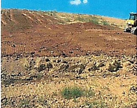
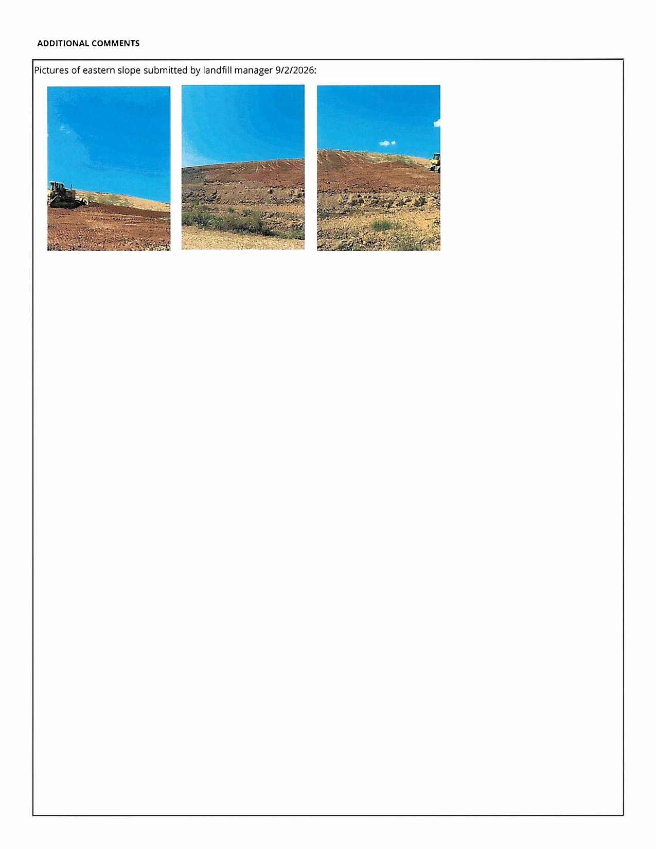
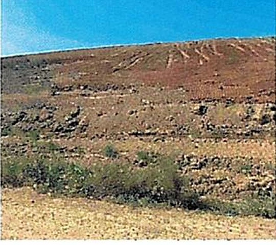
TDEC issued Areas of Concern for exposed waste and for flagging along the east slope, both tied to the availability of soil. The landfill manager submitted these photographs of that slope into the public record on September 2, 2026.
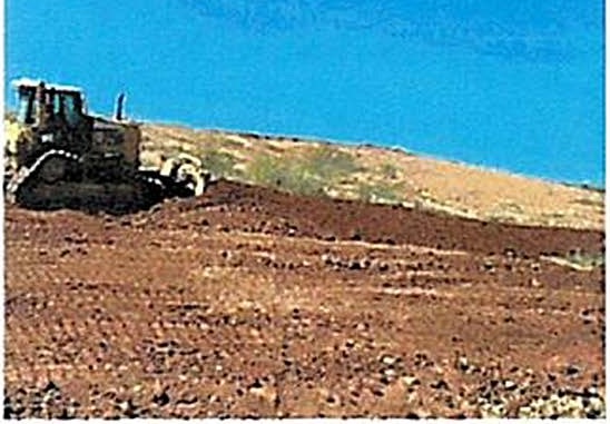
A bulldozer sits on the crest of a bare earthen slope at the landfill under a clear sky, with loose reddish-brown soil and scattered stone covering the foreground.
Eastern slope, looking up-grade. Bare soil, equipment working the crest. Submitted by the landfill manager, September 2, 2026.
A wide bare slope of reddish-brown soil with horizontal track marks across its face and a band of green weeds growing along the lower edge.
Slope face. Track-marked bare ground with vegetation only at the toe. Same submission.
A further view of the bare landfill slope with equipment at the top edge against a blue sky.
Third view, same date. These images accompany the Areas of Concern discussion in the packet.

Cover soil is the whole dispute. The site hauls roughly 400 to 600 cubic yards of soil a week for daily cover, but that hauled material cannot legally be used for final cover, which requires a certified two-foot compacted layer, geosynthetics and a further foot of topsoil. The on-site borrow soil that does conform is not accessible pending a grading permit.

"the site is currently hauling approximately 400–600 cubic yards of soil per week for daily cover. He clarified that this hauled material cannot be used for intermediate or final cover on capped slopes, which require a certified two-foot compacted conformance layer, geosynthetics, and an additional foot of topsoil meeting TDEC specifications." Engineering report, minutes of the August 20, 2026 meeting, September 17, 2026 packet, p. 8.

Chapter 04 Who is minding it

The chair resigned, and he was also the man holding the records.

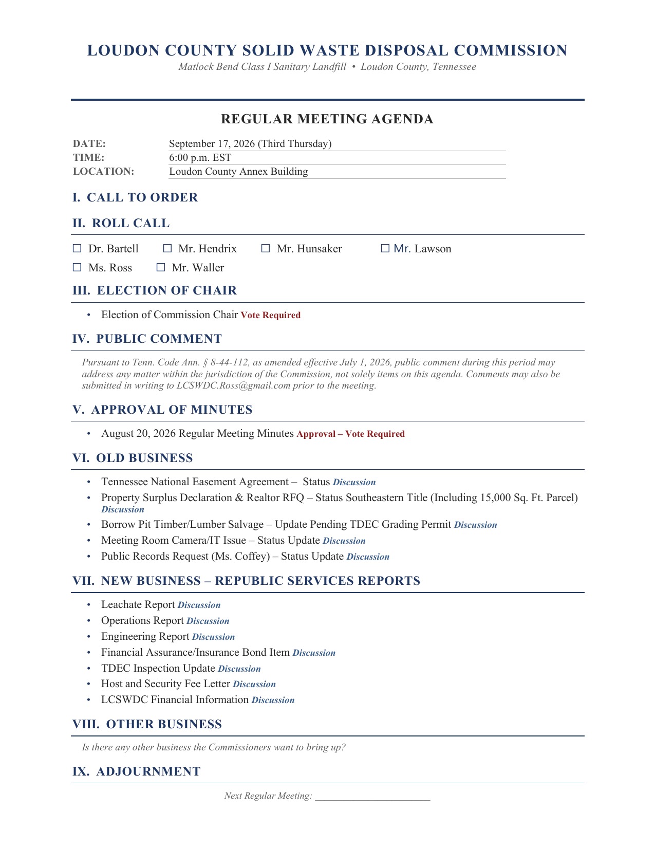
On September 17, 2026 the Commission opened by announcing that notice had arrived the previous day: Adam Waller had resigned from the Solid Waste Disposal Commission. He had held two jobs at once — chair, and the person in charge of the Commission's public records.

"so we um got yesterday we got a notice from um from Adam Waller that he has resigned from the commission. So we need um we need to elect a a chair." [00:06:39] · "Mr. Waller was both he was the chair and in charge of the public records." [00:17:46] Loudon County Solid Waste Disposal Commission, regular meeting, September 17, 2026, official livestream recording. Auto-generated captions; approved minutes pending. This site reports only that the resignation stated at this meeting is from the Solid Waste Disposal Commission. Whether it affects any other office he holds is not established by this record and is not claimed here.

Commissioner Ross was nominated and elected chair the same night, on a motion by Gary with a second from Tyler, Ross abstaining and no votes against. Vice chair, secretary and a replacement public records officer were all left unfilled — the incoming chair said she wanted to define the records job before asking anyone to take it.

"I'd like to nominate you." / "I second that." [00:07:00] · "but we have a motion from Gary and second from from Tyler." [00:07:10] · "Um, actually, not tonight. Um, because I need to talk to some people" [00:09:34] · "before I would do anything like that is that I would need to know exactly what I'm asking someone to do" [00:18:02] Same meeting recording. Auto-generated captions; approved minutes pending.

During public comment a citizen said the election was about five months late, that the Commission's own procedures called for it in April, and that the February through May minutes contain no mention of one. The chair acknowledged the point and committed to keeping to the calendar.

"Why are we doing the election in the month of September when according to the procedures and polic[y] that should have been done in April." [00:08:45] · "I went back and looked through all of the meeting minutes for February, March, April, and May. There's no mention of an election for chairman." [00:08:51] · "in the future we will try to keep on keep to the calendar." [00:09:23] Same meeting recording. Auto-generated captions; approved minutes pending.

A resident's public records request has now been outstanding more than sixty days. At the September meeting the Commission could not give a date for it.

"The request has now been outstanding more than 60 days; Ms. Ross indicated she would need to confirm with Chairman Waller and Ms. Murphy regarding the timeline given the size and complexity of the request." Public records request follow-up, minutes of the August 20, 2026 meeting, September 17, 2026 packet, p. 9.

The documents this page is built from
Chapter 05 What you can actually do

Three things, and none of them require a lawyer.